 | I just talked to a classmate who applied for and was approved to spend their winter break abroad. They will spend three short weeks working with a community in Central America to help improve their farming conditions. I guess this is the fifth year the University of Idaho has sent students down there. I wish I had known about this opportunity sooner. I have decided to apply for this next Winter (2013). If all goes well, I should be just starting my masters then. My summer camp experience made me think that I would like to pursue becoming a faculty at a university ... to do research - yes, but also to teach others and pass on my knowledge and excitement for learning onto the next generation of learners. |
|
0 Comments
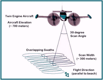 LIDAR is similar to radar technology, which uses radio waves, a form of electromagnetic radiation that is not in the visible spectrum. The range to an object is determined by measuring the time delay between transmission of a pulse and detection of the reflected signal. LIDAR technology has applications in Archaeology, Geography, Geology, Geomorphology, Seismology, remote sensing and many more areas. Light detection and ranging (LIDAR), also known as airborne laser scanning (ALS), is an emerging remote sensing technology with promising potential to assisting mapping, monitoring, and assessment of forest resources. Compared to traditional analog or digital passive optical remote sensing, LIDAR offers tangible advantages, including nearly perfect registration of spatially distributed data and the ability to penetrate the vertical profile of a forest canopy and quantify its structure. Applications of LIDAR range from archaeology, to atmospheric studies, bathymetry, etc. LIDAR has also found many applications in forestry. Canopy heights, biomass measurements, and leaf area can all be studied using airborne LIDAR systems. Similarly, LIDAR is also used by many industries, including Energy and Railroad, and the Department of Transportation as a faster way of surveying. Topographic maps can also be generated readily from LIDAR, including for recreational use such as in the production of orienteering maps. 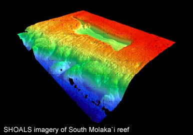 Text Source: http://wiki.gis.com/wiki/index.php/LIDAR
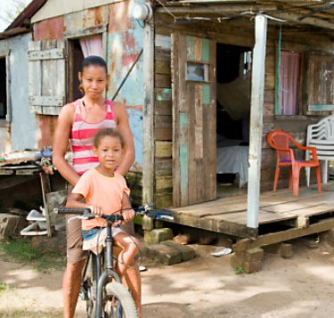
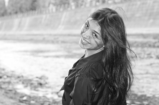
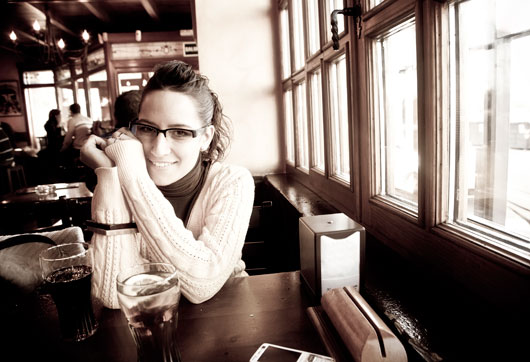
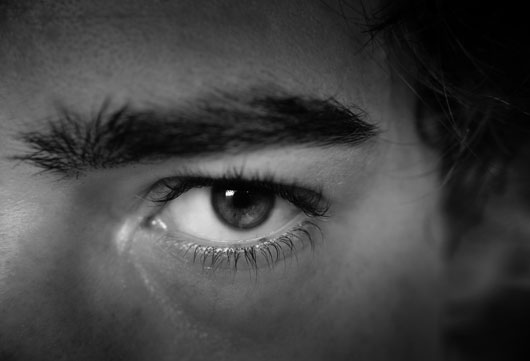
Image source: http://water.usgs.gov/osw/gps/GPS_projects.html  I just finished my photography class that I took as an elective this fall. I had so much fun in this class and learned a lot about the art of taking portraits. I learned how to help the subject relax so that their 'special sparkle' could be captured on film. I learned how to evaluate the images taken and feel confident in my final selection for the 'best image' from a photo shoot. Prior to this class, I stuck to black and white shots whenever possible—finding it must easier to express emotion with an image without the distraction of color. But my last image of the class required my use of color. What I found was that I loved the final result. Thus, I plan to experiment more with color in the coming year to see if I can make it work for me. I want to thank my friends who were great sports in letting me use them for my photo shoot subjects.
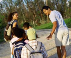 I really loved working with for the university's science camp for kids last summer. I was surprised at the enjoyment I got out of this service-oriented summer work. I was talking to a friend the other day about my summer experiences and he told me that he volunteers for a local group called Palouse-Clearwater Environmental Institute (PCEI). He said that they do a lot of work with kids and thought I might like volunteering there as well.
I checked out their website, http://www.pcei.org/, and am very interested and excited about this possibility. Who knew how many opportunities there might be, even in a small down like Moscow, to enrich your own life by making a difference in others? 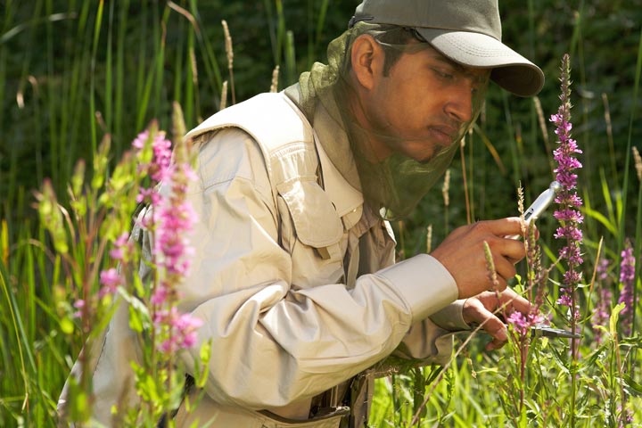 The large number and current complexity of terms makes interpretation of some of the invasion biology literature challenging and intimidating. Exotic, alien, transplanted, introduced, non-indigenous, and invasive are all words that have been used to describe plants and animals that have been moved beyond their native ranges by humans (Williams and Meffe 2005), along with other terms such as foreign, injurious, aquatic nuisance, pest, non-native, all with a particular implication. Even the use of what seem to be simple, basic terms to articulate ecological concepts "can confuse ideological debates and undermine management efforts" (Colautti and MacIsaac 2004). Attempts to redefine commonly used terms in invasion biology have been difficult because many authors and biologists are particular to a favorite definition (Colautti and MacIsaac 2004). Also, the status and identification of any species as an invader, a weed, or an exotic are "conditioned by cultural and political circumstances." (Robbins 2004)
 Exotic plant pathogens have been the cause of many devastating disease epidemics in America’s forests and agriculture. Famous examples include chestnut blight and white pine blister rust, both cases of native plants showing catastrophic susceptibility to the pathogen of a congener. This project tries to understand this phenomenon of resistance and susceptibility to pathogens of congeners by performing host-range inoculation experiments using a speciose plant genus and multiple isolates of its most common pathogen.
The plant genus Salix (willows) was chosen as an ideal group for inoculation experiments because in North America there are over one hundred native species and are commonly host to a rust fungus in the genus Melampsora. Twenty-six different Salix species were inoculated in three separate experiments with isolates from different hosts of this pathogen. Remote sensing is the small or large-scale acquisition of information of an object or phenomenon, by the use of either recording or real-time sensing device(s) that are wireless, or not in physical or intimate contact with the object (such as by way of aircraft, spacecraft, satellite, buoy, or ship). In practice, remote sensing is the stand-off collection through the use of a variety of devices for gathering information on a given object or area. Thus,Earth observation or weather satellite collection platforms, ocean and atmospheric observing weather buoy platforms, the monitoring of a parolee via an ultrasound identification system, Magnetic Resonance Imaging (MRI), Positron Emission Tomography (PET), X-radiation (X-RAY) and space probes are all examples of remote sensing. In modern usage, the term generally refers to the use of imaging sensor technologies including: instruments found in aircraft and spacecraft as well as those used in electrophysiology, and is distinct from other imaging-related fields such as medical imaging. 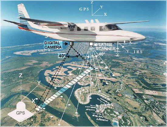 There are two kinds of remote sensing. Passive sensors detect natural radiation that is emitted or reflected by the object or surrounding area being observed. Reflected sunlight is the most common source of radiation measured by passive sensors. Examples of passive remote sensors include film photography, infrared, charge-coupled devices, and radiometers. Active collection, on the other hand, emits energy in order to scan objects and areas whereupon a sensor then detects and measures the radiation that is reflected or backscattered from the target. RADAR is an example of active remote sensing where the time delay between emission and return is measured, establishing the location, height, speed and direction of an object. Text Source: http://wiki.gis.com/wiki/index.php/Remote_sensing
Image Source: http://www.searchmesh.net/default.aspx?page=1726
Text source: http://en.wikipedia.org/wiki/Bradley_Joseph
A digital elevation model (DEM) is a digital representation of ground surface topography or terrain. It is also widely known as a digital terrain model (DTM). A DEM can be represented as a raster (a grid of squares) or as a triangular irregular network. DEMs are commonly built using remote sensing techniques, but they may also be built from landsurveying. DEMs are used often in geographic information systems, and are the most common basis for digitally-producedrelief maps. The terrain surface can be described as compromising two basically different elements-random and systematic elements. The random (stochastic) elements are the continuous surfaces with continuously varying relief. It would take an endless number of points to describe exactly the random terrain shapes, but these can be described in practice with a network of point. It is usual to use a network that creates sloping triangles or regular quadrants. The systematic part of the terrain surface is characterized either by sharp cracks in the terrain, such as the top or bottom of a road cut, or by characteristic points such as spot depression and spot height. The systematic part is best represented by lines and typical single points. Prominent terrain features can be verbally described using many terms, such as smooth slope, cliff, saddle and so on. Geometry, however, has only three terms: point, line, and area. One cannot describe continuously varying terrain using only three discrete variables, so all descriptions are necessarily approximations of reality[1]. 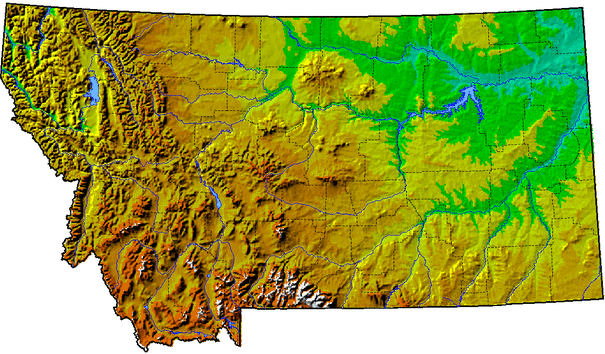 |
AuthorHi, I'm Felix. Here you'll find examples of my work and play. Categories
All
Archives
December 2012
|


 RSS Feed