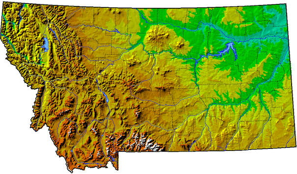
A digital elevation model (DEM) is a digital representation of ground surface topography or terrain. It is also widely known as a digital terrain model (DTM). A DEM can be represented as a raster (a grid of squares) or as a triangular irregular network. DEMs are commonly built using remote sensing techniques, but they may also be built from landsurveying. DEMs are used often in geographic information systems, and are the most common basis for digitally-producedrelief maps.
The terrain surface can be described as compromising two basically different elements-random and systematic elements. The random (stochastic) elements are the continuous surfaces with continuously varying relief. It would take an endless number of points to describe exactly the random terrain shapes, but these can be described in practice with a network of point. It is usual to use a network that creates sloping triangles or regular quadrants.
The systematic part of the terrain surface is characterized either by sharp cracks in the terrain, such as the top or bottom of a road cut, or by characteristic points such as spot depression and spot height. The systematic part is best represented by lines and typical single points. Prominent terrain features can be verbally described using many terms, such as smooth slope, cliff, saddle and so on. Geometry, however, has only three terms: point, line, and area. One cannot describe continuously varying terrain using only three discrete variables, so all descriptions are necessarily approximations of reality[1].

 RSS Feed