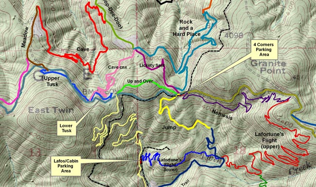
I am continuing my work with the local Mountain Bike club, MAMBA, to create a detailed map of the bike trails overlaid on a topo map. I am making great progress. My initial efforts for my GIS mapped 20 of the Moscow Mountain trails maintained by the club. Since then, I have continued adding additional trails to the maps with a goal of completing all 50 MAMBA trails.
I used a digital elevation model with the correct manipulation to create a shaded or 3-D effect on the hillsides. I created an overall map to depict a broad scale of 1:24,000 scale for quick reference with trail mileages (see image below), and then I made four maps at a finer scale 1:12,000 for increased detail. All mileages were computed in ArcMap GIS.
I used a digital elevation model with the correct manipulation to create a shaded or 3-D effect on the hillsides. I created an overall map to depict a broad scale of 1:24,000 scale for quick reference with trail mileages (see image below), and then I made four maps at a finer scale 1:12,000 for increased detail. All mileages were computed in ArcMap GIS.
 RSS Feed